Overview of Our Information Pages
On the following pages you will find information about various topics
We offer you answers to South Tyrol, Merano and Vinschgau at a glance and arranged thematically.
South Tyrol
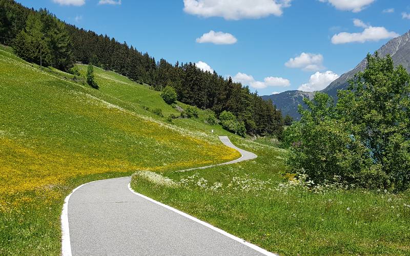
South Tyrol is a true paradise for cyclists and offers a range of impressive passes that provide both challenges and stunning views. Here are some of the most famous passes in South Tyrol.
- Stelvio Pass (Italian Passo dello Stelvio): At 2,757 m, this is one of the highest paved passes in the Alps. The ascent from Prad is particularly popular, offering 48 hairpin turns on the way to the summit.
- Timmelsjoch (Italian Passo del Rombo): A beautiful pass connecting South Tyrol with the Ötztal in Austria. It is located at 2,474 m and offers stunning views.
- Penser Joch (Italian Passo di Pennes): Located at 2,211 m, this pass connects the Sarntal and Wipptal (Vipiteno).
- Jaufenpass (Italian Passo di Monte Giovo): It is located at 2,094 m and connects the Passeiertal with the Wipptal (Vipiteno).
- Gampenpass (Italian Passo delle Palade): This pass, located at 1,518 m, connects the Adige Valley with the Non Valley.
- Karerpass (Italian Passo di Costalunga): A relatively lower pass (1,752 m) that connects the Eggental with the Fassa Valley and is located near the famous Lake Karer.
- Gardena Pass (Italian Passo Gardena): At 2,136 m, this pass lies between the Gröden Valley and the Gadertal. It offers fantastic views of the Dolomites.
- Sella Pass (Italian Passo Sella): This pass is located at 2,244 m and provides stunning views of the surrounding Dolomites.
- Würzjoch (Italian Passo delle Erbe): Located at 1,987 m, it's a less traveled pass connecting the Gadertal with the Villnöss Valley.
This list is by no means exhaustive, as South Tyrol offers many more smaller passes and roads worth exploring. Remember to check the respective weather and road conditions before you set out, as some of these passes might have snow and challenging conditions, especially outside the summer season. Safe travels!

The city of Bolzano, nestled in the heart of South Tyrol, is traversed by three significant rivers: the Adige, the Isarco, and the Talvera.
The Adige / Etsch, Italy’s second-longest river, grazes Bolzano and shapes the landscape of the surrounding area. It originates in the Alps at the Reschen Pass in South Tyrol and empties into the Adriatic Sea after about 415 km. Along the Adige, numerous recreational activities are available, including cycling, hiking, and fishing. The riverside promenade in Bolzano has been thoughtfully designed, providing a relaxing space for enjoying nature and the shimmering waters of the river.
Flowing through the center of the city is the Isarco / Eisack, an important tributary of the Adige. It springs from the Brenner Mountains and joins the Adige in Bolzano. The Isarco influences the cityscape and also offers a variety of opportunities for leisure activities. Its banks are popular walking paths, and the clear waters attract anglers.
The Talvera / Talfer, a smaller but characteristic river, originates in the Sarntal Alps and flows into the Isarco in Bolzano. It is especially known for the picturesque Talvera Meadows, a popular recreation area for locals and visitors alike. This idyllic spot invites walking, picnicking, and sporting activities, all while enjoying the impressive views of the surrounding mountains.
Each of these rivers lends Bolzano a unique character and contributes to the natural beauty and diversity of the region.
The summer and autumn months of July, August, and September are particularly popular. The period from April to October is ideal for hikers and cyclists, while skiers and winter hikers can enjoy the winter months.
Spring starts particularly early in the Merano region with temperatures around 20 degrees. By the end of March, the area around Merano has already awakened from its winter sleep.

Source: Meteorological Office – Bolzano
About two thirds of South Tyroleans speak German. In the autonomous province, German is an official language on an equal footing with Italian. In the Ladin parts of South Tyrol, Ladin is added as another official language.
South Tyrol was part of Tyrol until the end of the First World War. After the war, Austria had to cede many parts of the country, including South Tyrol.
Most locals speak in the South Tyrolean dialect, which differs from the standard German language.
In the valley basin of Merano, Bolzano and surroundings, the daily maximum temperatures in October reach a pleasant 18° C. In the Upper Puster Valley and Upper Venosta Valley, it can already be quite cool during this time of year.
The most popular holiday regions in autumn are: Merano and surroundings, South Tyrol's South, Eisack Valley.
Source: Meteorological Office – Bolzano
- Übeltaler Glacier: With 6.16 km² (2019) the largest glacier in South Tyrol. The glacier is located at the end of the Ridnaun Valley and got its name from its threatening rock faces. Altitude range: 2550 m - 3470 m
- Sulden Glacier: With 5.7 km² (2006) the second largest glacier in South Tyrol and is located on the eastern side of Ortler, Zebrù and Gran Zebrù peaks.
- Flintstone Glacier
- Rieser Glacier
- Lenkstein Glacier
- Zufall Glacier
- Lasa Glacier
- Fürkele Glacier
- Long Glacier
- Ortler Glacier
- Rieser Glacier
- High Glacier
- Ulten Market Glacier
- Schran Glacier
- Gepatsch Glacier
- Langtaufer Glacier
- Beardsbeard Glacier
- Freibrunn Glacier
- Planeil Glacier
- Matsch Glacier
- Graf Glacier
- Texel Glacier
- Kessel Glacier
- Prettau Glacier
- Outer Lahner Glacier
Glaciers are important reservoirs for freshwater. Especially in the dry Vinschgau Valley, glaciers are of enormous importance as water reservoirs, particularly for irrigating agricultural cultivation areas.
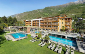
Merano
The Passer (Italian: Passirio) originates from several streams at the Timmelsjoch, runs through the Passeiertal and Meran, where it flows into the Etsch. With about 43 km, the Passer is one of the largest tributaries of the Etsch.
In the rear Passeier Valley between Moos and St. Leonhard, you can get very close to the Passer on the Passeirer Schluchtenweg. The impressive hiking trail follows the upper course on metal bridges and constructions, where the river has dug deep into the rock.
Fly fishing on the Passer - In the Passeier Valley there are ideal conditions for fly fishers, whether novice or professional: the Passer offers varied sections, fast and calm flowing areas.
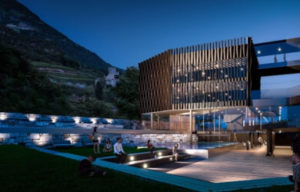
In the course of the project "The Passer for Merano - open spaces on the water", the so-called Passer terraces were created. Generously laid out lawn steps, near the Merano Thermal Baths, invite you to slow down and enjoy.
Merano is known for its mild climate and average temperatures in October range from 6 to 19° C.
Large weekly market in Merano
- Every Friday from 08:00 to 13:00.
- Clothes, shoes, leather goods, plants, food such as bread, sausages, cheese, fish, fruit, vegetables, etc.
- At Praderplatz, Andreas-Hofer-Straße, along Meinhardstraße to the Otto-Huber-Straße.
Small weekly market in Merano
- Every Tuesday from 08:00 to 13:00.
- Clothes, shoes, leather goods, food such as bread, sausages, cheese, fish, fruit, vegetables.
- At Praderplatz
Farmers' market on Brunnenplatz in Obermais
- Every Wednesday from 07:00 to 13:00.
- Seasonal fresh vegetables and fruit, as well as regional farmers' products.
Farmers' market in Meinhardstraße
- Every Wednesday from 08:00 to 12:00.
- Seasonal fresh vegetables and fruit, as well as regional farmers' products.
Farmers' market in G.-Galilei-Straße
- Every Saturday from 08:00 to 12:00.
- Seasonal fresh vegetables and fruit, as well as regional farm products.
MM - Merano Market - Regionality & Sustainability
- Every Saturday from 09:00 to 13:00.
- Meat specialities, cheese, fruit, vegetables, bread and herbs.
- Freiheitsstraße, Sandplatz
Merano Christmas Market 2025
- ?
- Closed on 25th December
- As the crow flies: 165 km
- Driving distance: 250 km (approx. 3h 30min)
The distance between Merano in South Tyrol / Italy and Munich in Germany is approximately 300 kilometers when considering the route via road. The exact distance can vary, depending on the specific route taken. The driving time by car is usually about 3 - 4 hours, depending on traffic conditions and the chosen route.
Option 1: Via the Brenner Pass
A frequently used route leads from Munich via the A8 and A93 to the A13 through Austria over the Brenner Pass, which is one of the main arteries through the Alps. After crossing the Brenner Pass, you continue on the A22 in Italy until you reach the Bolzano Sud motorway exit. From there, you will reach Merano on the expressway MeBo. This route is relatively fast and direct.
Brenner and Jaufen Pass
For a route that includes the Jaufen Pass, you would typically drive from Munich via Innsbruck, then southwards towards the Brenner Pass, but turn off towards Sterzing beforehand. From Sterzing, you can drive over the Jaufen Pass and through the Passeier Valley, which is a very scenic but winding and challenging route before you reach Merano.
Option 2: Via the Reschen Pass
An alternative and scenically attractive route takes you from Munich via the A95 or A96 and further on Austrian country roads towards Landeck, from where you cross the Reschen Pass, which connects Italy with Austria. After crossing the pass, you enter the Vinschgau and drive southwards to Merano. This route is particularly appealing because of the drive along the Reschen Lake and through the Vinschgau.
The most important car parks in Merano:
- St. Josef car park
- Merano Thermal Baths car park
- Karl Wolf car park
- Plaza multi-storey car park
- Algund Winery multi-storey car park
- Car park Meranarena
- Obermais multi-storey car park
- Parking Prader Platz (free)
- Untermais railway station car park (free)
Val Venosta
The road over the Reschen Pass is free of charge all year round. There is no winter closure and no toll. The Reschenpass is therefore very popular with car travellers. In the summer months and autumn there are often long traffic jams in the Vinschgau Valley from Mals to Meran. We recommend an alternative route via the Brenner Pass, the Timmeljoch or travelling by train if there is a lot of traffic.
From Italy over the Reschen Pass by bike:
From Mals in the Vinschgau Valley, the well-maintained cycle path leads to Burgeis and on to Lake Reschen. Along the western shore of the lake you reach the village of Reschen and get to the Reschen Pass. From there you cross the border to Austria.
From Austria over the Reschen Pass:
From Landeck we follow the "Via Claudia Augusta" cycle path with partly steep climbs to Prutz. Up to Pfunds it is flatter again. A section continues into Switzerland to the town of Martina, where the climb to the Reschenpass begins. There are 11 hairpin bends to negotiate by bike, and at the pass near Naudersmühlen the route descends to Nauders and on to the border crossing. After another climb at the pass, you experience a wonderful view of Lake Reschen.
Clockwise or counterclockwise, the loop around Lake Resia can be cycled. There are a many possibilities for the starting place:
- at the parking lot near the famous church tower of Altgraun
- in the village of Reschen
- at the parking lot in the south of the Reschensee
- cycle path Vinschgau from Mals
- Etsch cycle path from Reschenpass
Start at the parking lot near the church tower in the lake
We follow the gravel road to the south, continue around the kite spot - on our left the road and on our right the lake - continue to the dam. When the weather is nice, we have a fantastic view of the Ortler, the highest mountain in South Tyrol at 3,905 meters. We cross the dam wall and follow the asphalt bike path back north along the west bank of the Reschsee. The cycling path leads through woods and meadows with slight inclines to Reschen and there we again follow a gravel path back to the starting point.
In total there are 70 meters of altitude. Length of the tour: 15 km.
Who is the bike path around the Reschensee suitable for?
Ideal as a leisurely excursion for families or as a cycling introduction for gravel or MTB bikers. The bike path is not suitable for racing bikes because the lake circuit is only partially asphalted.
Information
Vacation in South Tyrol